Getting to the root of property risks - Geospatial Data Intelligence goes deeper and wider

Caroline Elliott-Grey, product manager and Heikki Vesanto, manager, GIS data science, LexisNexis Risk Solutions, Insurance, UK and Ireland
There is no doubt that pricing has become more challenging for property insurance professionals over the last few years. Aside from the changes in risk created by climate change, there is a need to understand if new trends in crime related claims such as arson and burglary in lockdowns, were anomalies or the start of longer-term changes in crime patterns.
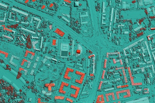
It has therefore become imperative for insurance providers to leverage new and refreshed data sources to better understand the environmental and structural risks of the properties they are insuring – from the location and height of nearby trees to the presence of a basement and local crime rates.
Basements and cellars of any kind in home and commercial buildings are becoming more prone to flooding, particularly in urban, high-density areas across the UK, including London where flash flooding is occurring on a regular basis. This is down to a combination of reduced surface permeability, clay soils and the ageing drainage and sewage systems. The problem isn’t going away – instead it is predicted to get worse with daily rainfall rates expected to rise by 7% and severe downpour events on course to rise by 14%.
The good news is that insurance providers can now understand whether an individual property they are insuring has a basement using the recently launched LexisNexis® Basements Indicator so that this can be factored into pricing at the point of quote. Viewed in tandem with live flood data direct from the Environment Agency, insurance providers can be fleet of foot in pricing and risk mitigation in a flood event, pinpointing the homes and businesses most likely to be affected.
Knowing that trees are implicated in 70% of reports of subsidence and heave on clay soil, and tree damage is common in windstorms, building the picture of risk, insurance providers can also understand the proximity of trees that could pose a problem to an insured property, through streamlined access to the National Tree Map™ (NTM™) from Blue Sky.
Key characteristics such as how many kitchens and bathrooms the property has, the elevation of the property, its construction type, the purchase value and rebuild cost can all be revealed alongside perils data at point of quote. But perhaps one of the most powerful insights is prior claims for the property. Through LexisNexis® Precision Claims, it is now possible to understand whether the property has ever had a claim for a flood, storm damage or indeed a basement flood. A wish that ‘if only walls could talk’ is now becoming a reality for the property insurance market.
Environmental risks also extend to crime rates but crime trends have changed in the last two years with burglaries falling by half between 2019 and 2021. So our data analysts have been working hard to evolve our Crime Model and offer Arson and Burglary Scores using crime data going back a decade or more. By using short-term changes seen in crime patterns during the lock down and longer-term risks facing the markets today, crime data can better predict the risk of crime losses.
We already know the cost-of-living crisis is driving a 25% rise in fraudulent property claims for certain insurers but the market will also be considering if crime such as theft and arson will increase again due to financial stress. The pressure is on to price fairly and accurately based on the clearest picture of crime risk.
Ultimately, property insurance providers need to ensure the data they use at quote through to claim gives them the most comprehensive understanding of the risk posed by the property and the policyholder without impacting the speed of service delivered to the customer. It could be a tough challenge given the scope of data that is now available to the market. But that’s precisely why we are constantly enhancing the geospatial data intelligence we can deliver direct into insurance processes through LexisNexis® Informed Quotes and for data visualisation in LexisNexis® Map View to make the property risk assessment process as efficient, fair and accurate as possible.
About LexisNexis
At LexisNexis Risk Solutions, we believe in the power of data and advanced analytics for better risk management.
With over 40 years of expertise, we are the trusted data analytics provider for organisations seeking actionable insights to manage risks and improve results while upholding the highest standards for security and privacy.
We enable insurers and brokers to improve decision-making, increase profitability and transform business performance with actionable insights from our data and analytics solutions. For more information, please contact risk.lexisnexis.co.uk/insurance or enquiries-info@lexisnexis.co.uk.

